Settling in at McMurdo

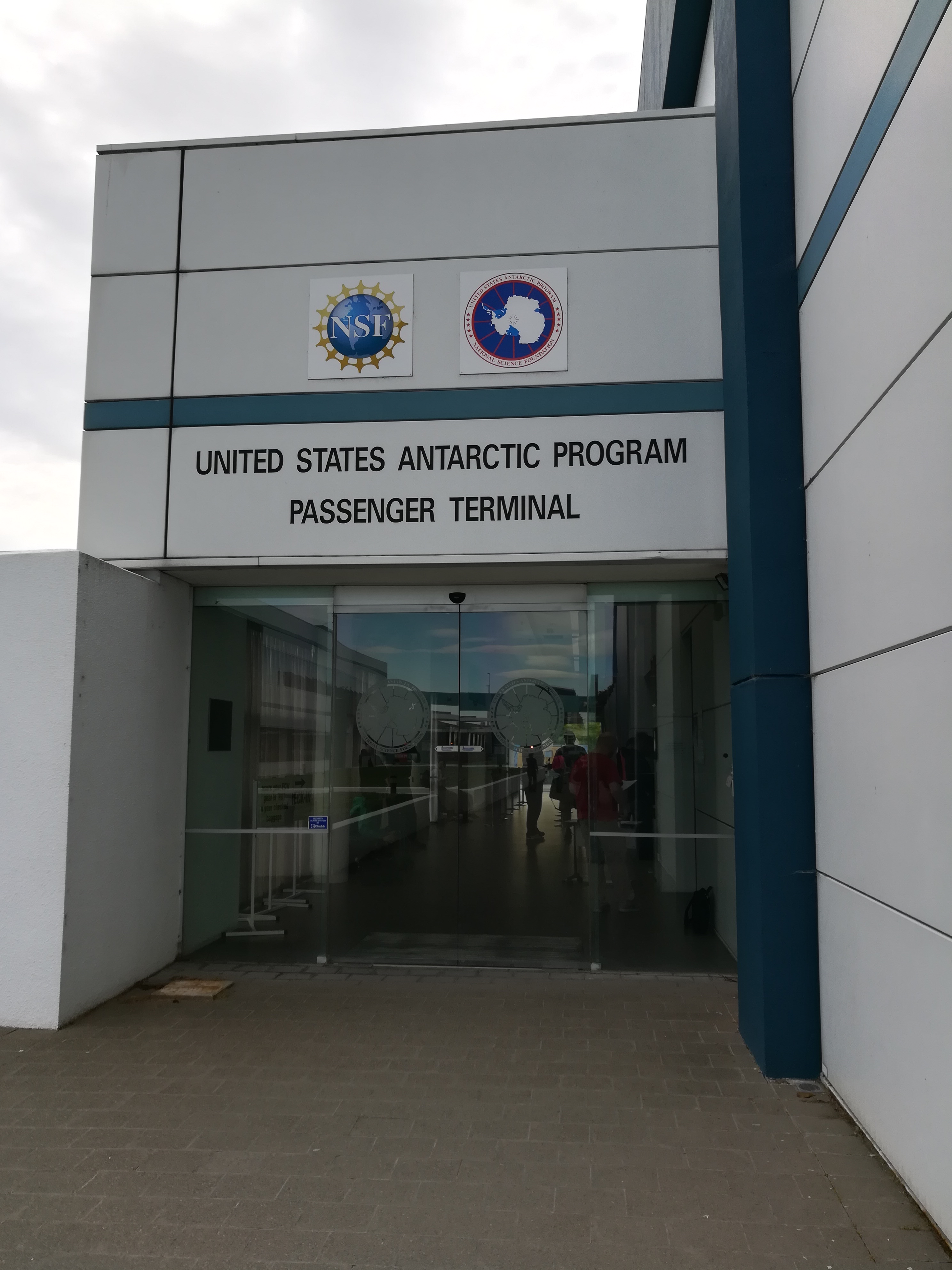
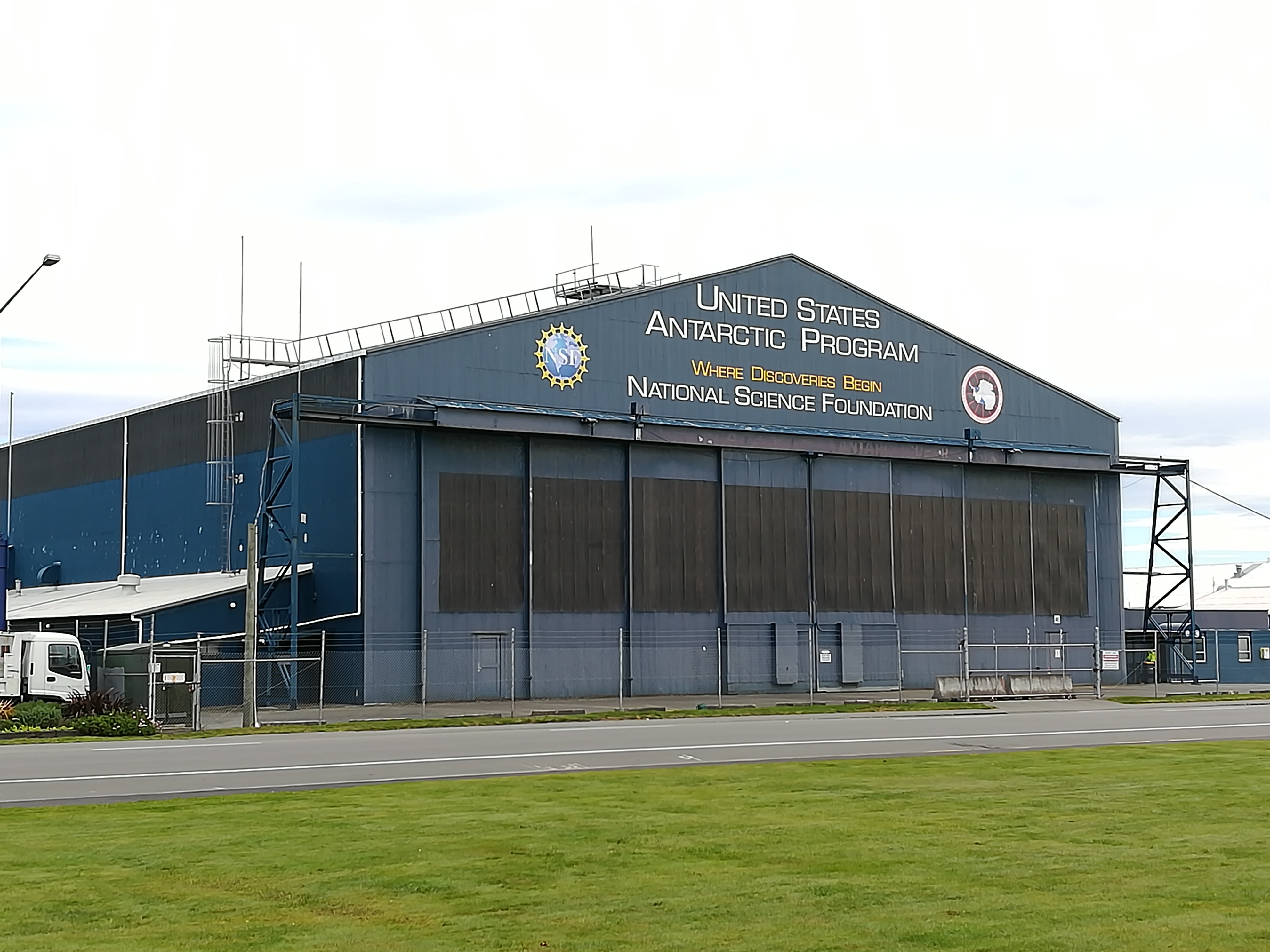
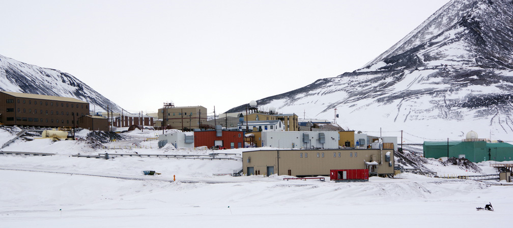
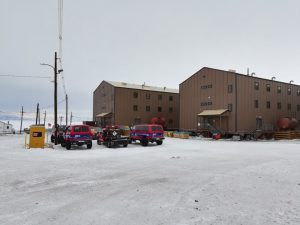
After a few days, I am getting used to life in McMurdo. It is a small village built on land but surrounded by sea ice and the ice shelf. There are quite a variety of buildings around the town, each with a specific purpose. There are field supply buildings, offices, cargo storage, carpentry buildings, gyms, a medical building, and fuel pump houses to name a few. So far, I have spent most of my time in the dormitories, galley, and in the Crary Science and Engineering Center where we have a work space. I have also been to several of the other buildings for training and to start to gather supplies for our work out at the airfield.

The dorm rooms here are comfortable. They have everything we need (bed, dressers, desk, and even a fridge). We share with one other person (happily, we sorted it out so it’s another member of our team).

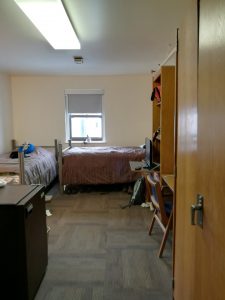
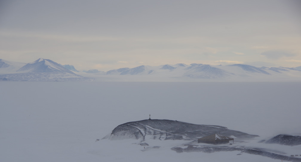
And our team is all on the same floor, which makes it nice for gathering and communicating necessary information to each other. And, as far as dorms go, I probably have one of the most spectacular views possible out my dorm window, so I really can’t complain!

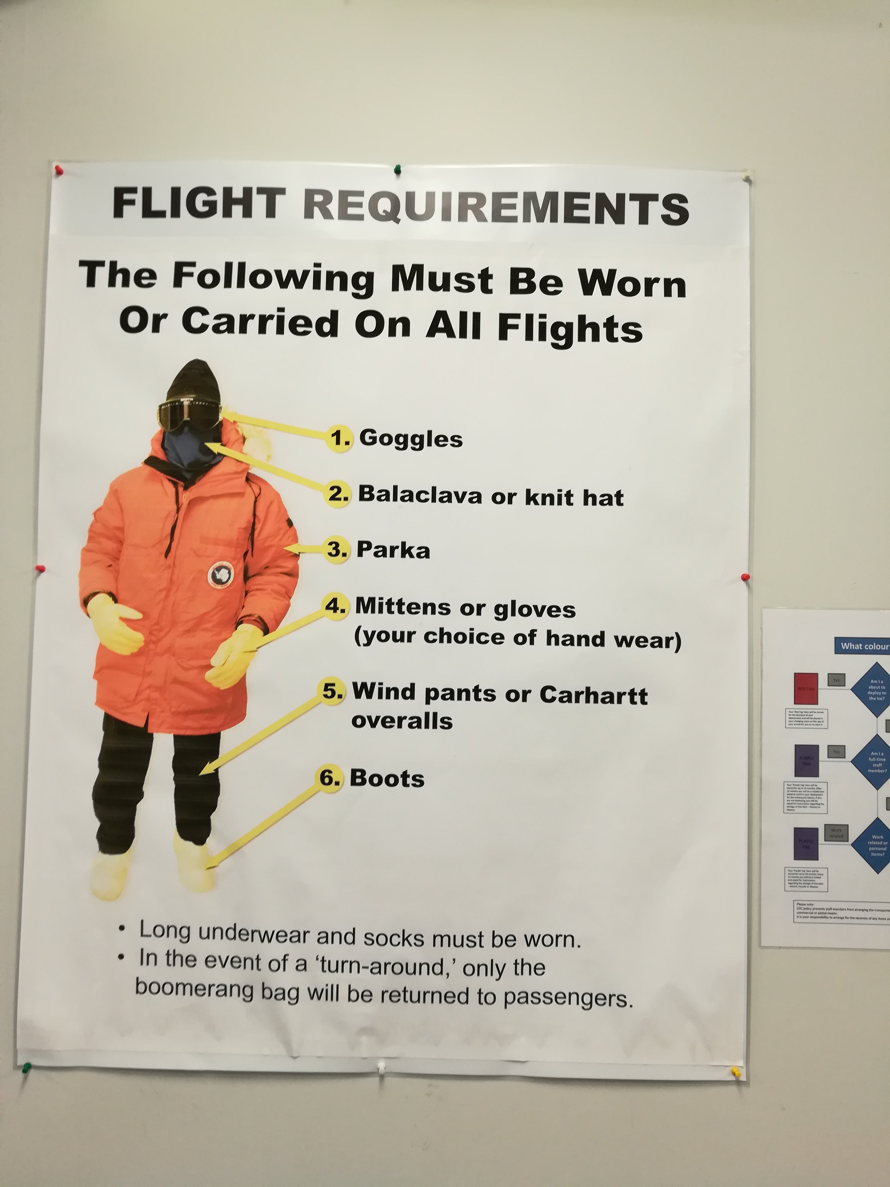
These first few days here have mainly been packed with training classes and getting to know our way around as we prepare to get to work. The environment here is very harsh AND we have to be very careful of our footprint here as we live and work in Antarctica. So, there is a lot to learn about! We have had briefings on fire safety, waste management, spill cleanup, outdoor recreation safety, IT setup, and the “Environmental Awareness, Field and Dry Valley Safety Briefing”. We have also had to take driver training classes so we can drive the big tire F350 trucks here on the ice, and snowmobile training – and then a safety training on driving both of those near the airfield. And, tomorrow, we have our last one: the “Antarctic Field Safety” class. All of these classes help us work and live safely around here and minimize our impact on the environment, in accordance with the Antarctic Treaty.

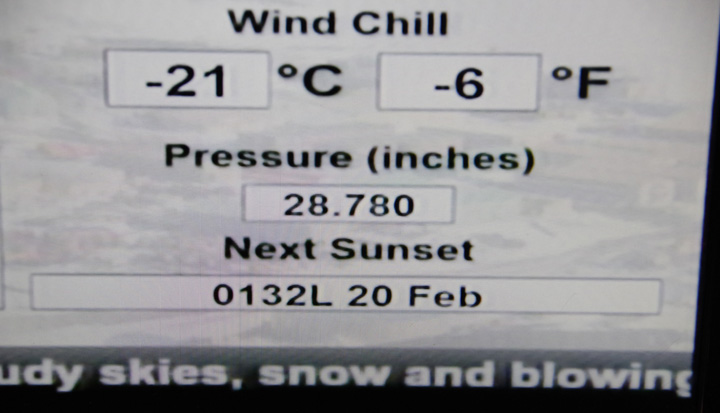
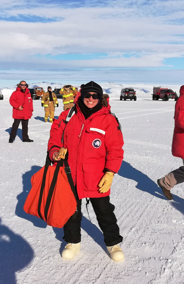
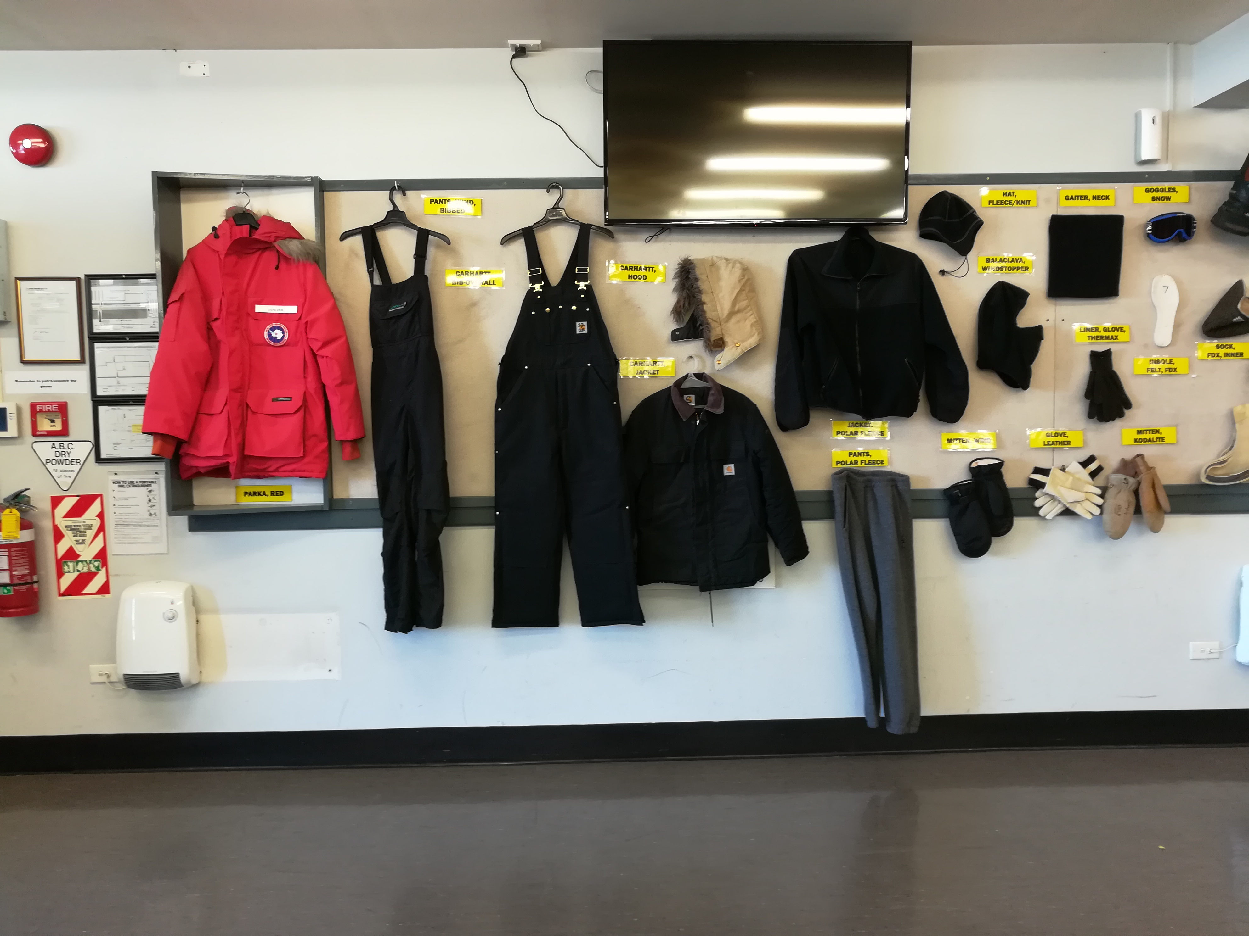
Other than that, I am just trying to get used to the cold (which isn’t too bad on a calm sunny day but can be wicked when it’s windy!!) and the constant daylight. We got here the day after the last sunset! The monitors where they list current weather conditions tell me that the next sunset is on Feb 20, 2018! Luckily our rooms have black-out shades, and I brought an eye mask, which helps a lot when trying to sleep. As for the cold, I always have my wool base layers on underneath my clothing and have been wearing my “Big Red” (the red parka they issue us) with hat, gloves, and neck warmer whenever I am outside.

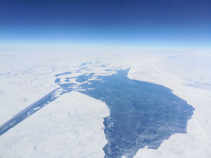
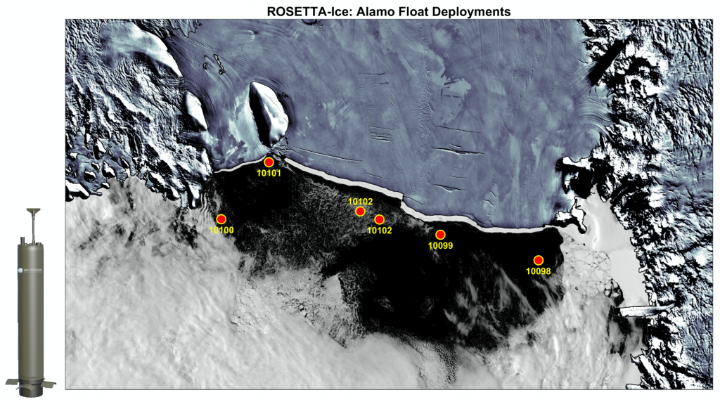
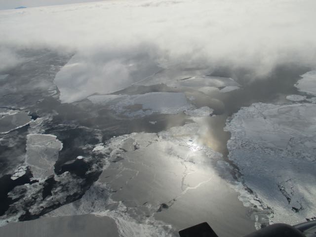
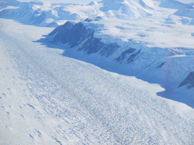
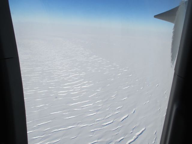
Our next big step is to get our work tent setup at Williams Airfield so we can start our flights out to map the Ross Ice shelf. Weather has been causing some delays, but they are predicting better weather tomorrow! So, with some luck, we will get our tent set up and fly our first check-flight on Monday.

Flight to the Ice


It has been a busy couple of days, but I am getting settled in and have a network connection, so I wanted to write about what has been happening.

After a few delays, our flight left Christchurch on Tuesday, October 24th around noon (only a day after I was originally scheduled to leave, but 4 days late for many people there).

They loaded us all (111 people) into a C-17, which is one of the largest military transport planes. It was a pretty fun flight. There are seats all along the sides of the plane and they added additional seats in the middle. They often put cargo there, but on this flight, they needed to get a lot of people down to the Ice so they crammed as many people in as possible. But, I had more room on this flight than on the commercial flight I took down to New Zealand from the States. The only downside was that the plane was really loud, so wearing earplugs or headphones was important.

When we boarded the airplane, we are given a sack lunch and a water bottle to last us through the trip, plus some extra food in case we have to “boomerang” and turn around before we make it down there. The flight on the C-17 is only 5 hrs from Christchurch to McMurdo, and happily we made it down there with no other issues.

As we neared the continent, we could see sea ice out the windows. And the pilots let us go up in pairs to look out the cockpit windows. Antarctica from the air was beautiful.

We landed on the ice runway at Phoenix airfield on a beautiful sunny day. Phoenix is a new airfield on the ice shelf that opened last year.

We exited the airplane right onto the ice. We all gathered around and got a few photos before getting on buses and heading to McMurdo where we had more briefings, dinner, got our rooms, and settled in.


Christchurch and Deployment Preparations

Today is my scheduled Ice Flight to McMurdo Station.  I woke up at 4 am to get ready to leave and received phone call at 4:40 notifying me that the ice flight was delayed for 4 hrs.  So, I took a nap, had a good breakfast, and now have time to write this post!

I arrived here on Saturday after about 30 hrs of traveling (my house – to the hotel here in Christchurch).  New Zealand is a day ahead and 4 hrs behind Seattle time, so I skipped Friday!

On my flights here, I met quite a few people traveling to McMurdo as well. Some are grantees (people working on the science projects) working on the ice for a month or 2, and some are support people who will be here for the entire field season (4 months).  There are people studying neutrinos, and doing research in the dry valleys.  And there are people with firefighting jobs, and heavy equipment operators. I even met a nurse who loved spending the summer season here doing all sorts of jobs.  This year, she is a janitor. Some have been here for 16 seasons.  And, for some of us (like me), it is our first season at McMurdo.

On Sunday, shuttles picked us up from several different hotels and took us to the United States Antarctic Program (USAP) Clothing Distribution Center.  This is also the terminal where we will board our planes from.   We had briefings there, had our laptops screened for viruses, got flu shots, and were issued our Extreme Cold Weather (ECW) Gear.

Examples of the Clothing we were issued.

Today, we have to wear our core gear (parka, pants, boots, balaclava, gloves) on the the flight that takes us to the Ice.

Core gear that that we must have with us on the plane.


While I was here in Christchurch, I also able to meet up with the rest of my team.  They arrived 3 days before me and were supposed to already be on the ice when I arrived.  But poor weather conditions at McMurdo have caused delays for several days and they haven’t been able to send their flight to McMurdo yet.  So, the new plan is to get all of us (from both flights) out today on a C-17,  which is a large military transport plane (much larger than the C-130s).  There are 111 of us total for the flight scheduled today, plus all of our gear and I am sure cargo.

So far, I haven’t received any new updates!  So, hopefully, the next time I write, it will be from McMurdo!

UPDATE:  About an hour after I wrote this, while I was taking my bags to the front desk to check out, I received a message that we had a 24 hr fly delay.  So, we will try again tomorrow!


ROSETTA-ICE team heads back to Antarctica

The ROSETTA-ICE team is once again heading back to Antarctica to map the Ross Ice shelf.  And this year, I will be joining them!  When I am down there, I will be posting about what it is like to work in Antarctica and more about the ROSETTA-ICE project.

I want to say a special hello to Ms. Ishii’s 5th grade class at Henry David Thoreau Elementary School in Kirkland, WA!  They will be following along and I am sure they will be asking great questions.

I leave on Oct 19th, and will make my way to McMurdo Station in the Ross Sea area, where I will meet the rest of the team.

My route to get to McMurdo is shown above.   I go from Seattle to San Francisco to Auckland, New Zealand to Christchurch, New Zealand  to McMurdo Station, Antarctica.   I take regular, commercial flights down to Christchurch, where I get to spend two nights, before taking a military flight down to Antarctica.  On the full day that I am in Christchurch, I will get issued my polar gear that is required when traveling and working there.

If you want to know about who I am, please visit my staff page (Susan L. Howard).


ROSETTA-Ice launches five more ALAMOS

ROSETTA-Ice launched five more ALAMO ocean profilers from an Air National Guard C-130 Hercules yesterday. First clear day for weeks, and the last available day to fly. Graphic shows the deployment locations.

These profilers should report back daily while sea ice is clear. In winter, they will be covered by sea ice but will continue to profile, then send us back their data next summer when the ice clears away again.

Congratulations to the entire ROSETTA-Ice team, but in particular Kirsty Tinto and Dave Porter (Lamont-Doherty Earth Observatory) and Scott Springer (ESR).
alamo_float_deployments_sm

Read more at ESR’s Facebook page.

ROSETTA-Ice launches first Alamo float in Ross Sea

Scott Springer (ESR) was part of the team making the first successful launch of an Alamo (air-launched autonomous micro observer) profiling float in the Ross Sea. The Alamo float measures profiles of temperature and salinity from the surface to the seabed in this difficult-to-reach part of the world. About once per day, the profiler comes to the surface and makes a phone call to send its data home to researchers in the US.

Learn more here.

ALAMO, take 2

We return to the ocean the next day with better weather

img_1728
A clear view of open water at our proposed drop site.

The crew flies over our proposed site, descends to 300 feet and then climbs back to 2500 feet to check the wind speed and direction. While we turn around to return to the drop site, the cargo deck crew prepares the ALAMO float.

img_1735
The crew prepares to open the cargo door as we near the drop site.

We scientists are seated along the sides (with our seatbelts fastened) and the loadmasters don harnesses and tether themselves to anchor points on the cargo deck.  It’s time to open the cargo door!

img_1743-3
With the cargo door open, the backlighting overwhelms my camera. Sgt. Ray is prepared to give the signal to launch.  The line going upward will trigger the parachute deployment when the float falls away from the plane.

When the navigator tells the loadmaster that we are at the proper location, they launch the ALAMO, its parachute deploys, and it drifts out of sight quickly, before we can see if it landed in the water.

tej_alamo_launch
Sgt Ray watches the orange parachute of the ALAMO float drift away (Photo: Tej Dhakal)

Everyone wants to know that the ALAMO landed safely in the water, so Major Hicks circles back several times while we search the surface of the ocean for the orange parachute.  We never saw any sign of it.

When we land, Kirsty comes on board with a smile on her face and says that the ALAMO float has already sent us an email to say that it has successfully made its first measurements!

ALAMO floats

In addition to mapping the properties of the Ross Ice Shelf with the IcePod, we measuring the ocean properties just north of the ice shelf. We will do this with ALAMO floats (Air Launched Autonomous MicroOberserver). ALAMO floats measure three critical properties of the ocean: temperature, salinity, and pressure. They do this while slowly sinking to the bottom of the ocean and then rising back to the surface. When they are at the surface, they place a phone call via Iridium satellites and literally email their data back to us.

ALAMO floats are a fairly new technology which has been used mostly in warm subtropical waters to date. A major complication in polar waters is the possible presence of sea ice. The ALAMO floats have a sea-ice-avoidance algorithm that detects whether there is likely to be sea ice as they rise upward, and to not surface if sea ice is likely to be present. The sensors and communications electronics are on top of the float, and we don’t want it to get damaged by running into sea ice from below.

The floats are deployed from the air, which makes it possible to go places that ships can’t go. A perfect example of such a location is the waters just north of the Ross Ice Shelf. In this region, the sea ice melts out near the ice shelf in late November while there is still lots of ice to the north, keeping ships away. An icebreaker, the Nathaniel B. Palmer, is the first ship scheduled to visit this region in late January. By deploying the ALAMO floats by airplane, we can make ocean measurements 6-8 weeks sooner than we could make them from a ship. These springtime measurements will contribute to our understand of the seasonal cycle of the sea ice in this region.

Our first challenge is that we need to be able to see where we are deploying the floats. In particular, we need a day without low clouds, which are quite common in this area. Our second challenge is that we need to be sure that we are dropping the floats into water and not onto sea ice. Satellite images help us in our planning, but in the end we just have to fly out there and look firsthand.

img_1693
A forklift delivers the ALAMO float to the cargo hold of the C130. The float is inside a cardboard box so that the parachute cords do not snag the sensors during the launch. When it hits the water, the box falls apart and the ALAMO floats away.
img_1647
The crew members run through their procedures for the launch before we take off. This is just the last of many discussions. They are very careful about throwing things out of airplanes!
img_1689
When we get out over the ocean, we find lots of sea ice and low clouds. The pilot decides that visibility is too poor to try the launch, so we return to the ice shelf to do some IcePod mapping instead. ALAMO will have to wait for another day.

End

Looking out the window

start

img_1463-1
The flight crew invites Isabelle and me to sit on the flight deck for take off.
img_1476
We fly by the summit of Mt Discovery shortly after leaving Willie Field. Minna Bluff extends about 30 miles to the east (upward in this picture).
img_1593
We fly southward along the Transantarctic Mountains, which provide dramatic scenery.
img_1580
Large glaciers flowing out of the mountains are the source of ice that becomes the Ross Ice Shelf along its western side.

We turn eastward and fly away from the mountains.  The ice shelf is a  sheet of snow-covered ice as far as the eye can see. In places where ice is under stress, it forms large cracks known as crevasses.

img_1573
Crevasse field

but for the most part the ice shelf is nearly featureless except for small wind ripples in the snow.

img_1604
Shadow of plane on the snow.

Although the vast, often featureless ice shelf is an amazing sight, there is much more to be learned from our instruments than from looking out the window.