ALAMO, take 2

We return to the ocean the next day with better weather

img_1728
A clear view of open water at our proposed drop site.

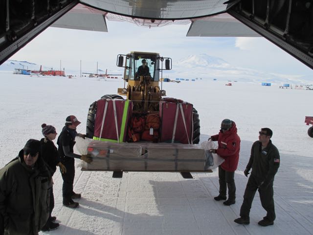
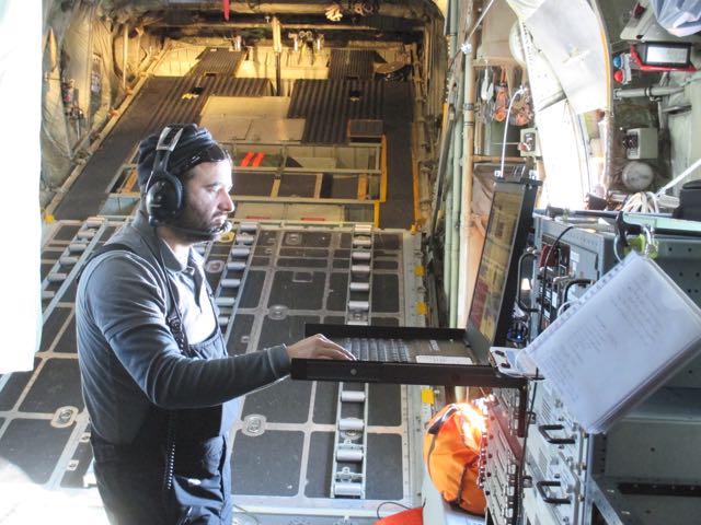
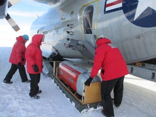
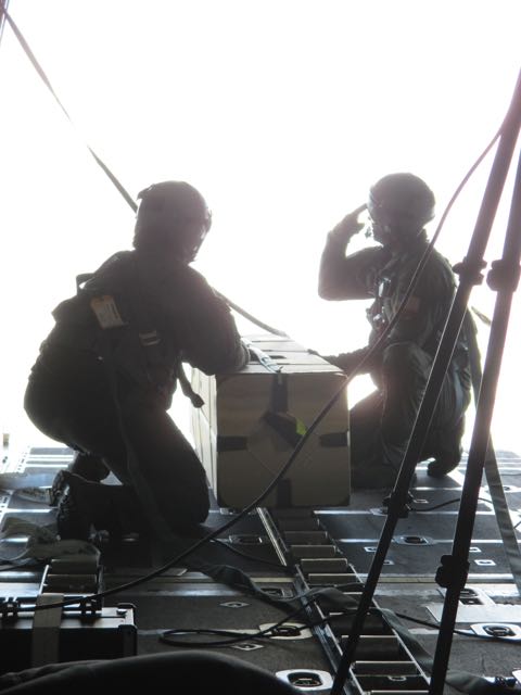
The crew flies over our proposed site, descends to 300 feet and then climbs back to 2500 feet to check the wind speed and direction. While we turn around to return to the drop site, the cargo deck crew prepares the ALAMO float.

img_1735
The crew prepares to open the cargo door as we near the drop site.

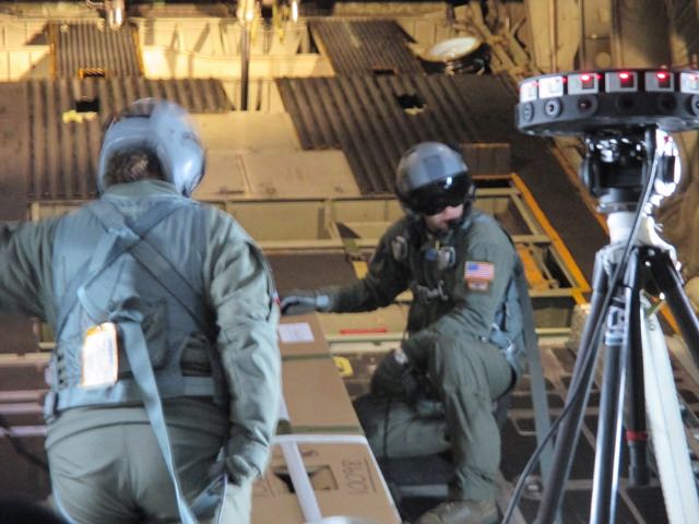
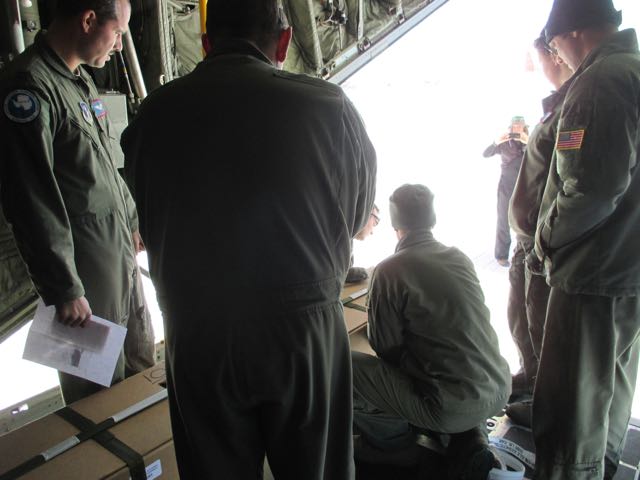
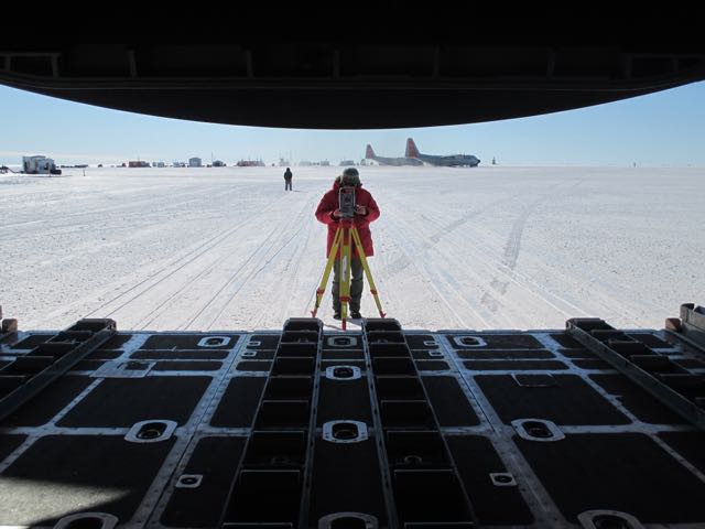
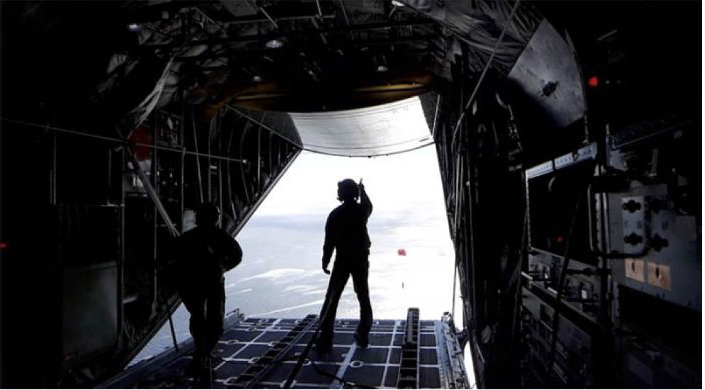
We scientists are seated along the sides (with our seatbelts fastened) and the loadmasters don harnesses and tether themselves to anchor points on the cargo deck.  It’s time to open the cargo door!

img_1743-3
With the cargo door open, the backlighting overwhelms my camera. Sgt. Ray is prepared to give the signal to launch.  The line going upward will trigger the parachute deployment when the float falls away from the plane.

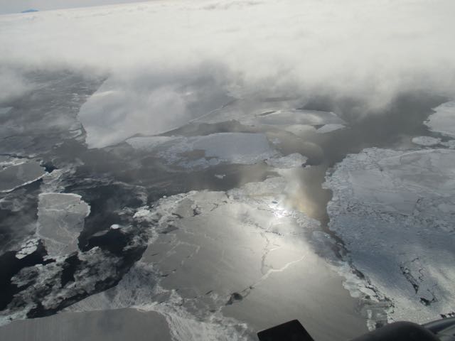
When the navigator tells the loadmaster that we are at the proper location, they launch the ALAMO, its parachute deploys, and it drifts out of sight quickly, before we can see if it landed in the water.

tej_alamo_launch
Sgt Ray watches the orange parachute of the ALAMO float drift away (Photo: Tej Dhakal)

Everyone wants to know that the ALAMO landed safely in the water, so Major Hicks circles back several times while we search the surface of the ocean for the orange parachute.  We never saw any sign of it.

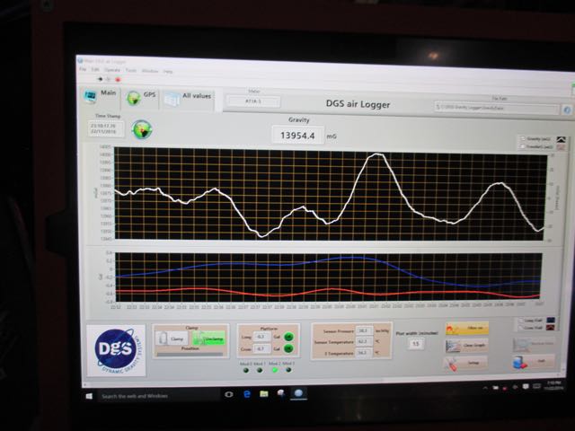
When we land, Kirsty comes on board with a smile on her face and says that the ALAMO float has already sent us an email to say that it has successfully made its first measurements!

ALAMO floats

In addition to mapping the properties of the Ross Ice Shelf with the IcePod, we measuring the ocean properties just north of the ice shelf. We will do this with ALAMO floats (Air Launched Autonomous MicroOberserver). ALAMO floats measure three critical properties of the ocean: temperature, salinity, and pressure. They do this while slowly sinking to the bottom of the ocean and then rising back to the surface. When they are at the surface, they place a phone call via Iridium satellites and literally email their data back to us.

ALAMO floats are a fairly new technology which has been used mostly in warm subtropical waters to date. A major complication in polar waters is the possible presence of sea ice. The ALAMO floats have a sea-ice-avoidance algorithm that detects whether there is likely to be sea ice as they rise upward, and to not surface if sea ice is likely to be present. The sensors and communications electronics are on top of the float, and we don’t want it to get damaged by running into sea ice from below.

The floats are deployed from the air, which makes it possible to go places that ships can’t go. A perfect example of such a location is the waters just north of the Ross Ice Shelf. In this region, the sea ice melts out near the ice shelf in late November while there is still lots of ice to the north, keeping ships away. An icebreaker, the Nathaniel B. Palmer, is the first ship scheduled to visit this region in late January. By deploying the ALAMO floats by airplane, we can make ocean measurements 6-8 weeks sooner than we could make them from a ship. These springtime measurements will contribute to our understand of the seasonal cycle of the sea ice in this region.

Our first challenge is that we need to be able to see where we are deploying the floats. In particular, we need a day without low clouds, which are quite common in this area. Our second challenge is that we need to be sure that we are dropping the floats into water and not onto sea ice. Satellite images help us in our planning, but in the end we just have to fly out there and look firsthand.

img_1693
A forklift delivers the ALAMO float to the cargo hold of the C130. The float is inside a cardboard box so that the parachute cords do not snag the sensors during the launch. When it hits the water, the box falls apart and the ALAMO floats away.
img_1647
The crew members run through their procedures for the launch before we take off. This is just the last of many discussions. They are very careful about throwing things out of airplanes!
img_1689
When we get out over the ocean, we find lots of sea ice and low clouds. The pilot decides that visibility is too poor to try the launch, so we return to the ice shelf to do some IcePod mapping instead. ALAMO will have to wait for another day.

End

Looking out the window

start

img_1463-1
The flight crew invites Isabelle and me to sit on the flight deck for take off.
img_1476
We fly by the summit of Mt Discovery shortly after leaving Willie Field. Minna Bluff extends about 30 miles to the east (upward in this picture).
img_1593
We fly southward along the Transantarctic Mountains, which provide dramatic scenery.
img_1580
Large glaciers flowing out of the mountains are the source of ice that becomes the Ross Ice Shelf along its western side.

We turn eastward and fly away from the mountains.  The ice shelf is a  sheet of snow-covered ice as far as the eye can see. In places where ice is under stress, it forms large cracks known as crevasses.

img_1573
Crevasse field

but for the most part the ice shelf is nearly featureless except for small wind ripples in the snow.

img_1604
Shadow of plane on the snow.

Although the vast, often featureless ice shelf is an amazing sight, there is much more to be learned from our instruments than from looking out the window.

Shakedown flight


img_1439
Part of the ROSETTA crew walking out to the plane at Williams Field.
img_1442
Kirsty is the Field Principal Investigator whose job is to keep the thirteen of us working like a machine. Here she gives some last minute instructions before the flight.
img_1490
Tej manages the Icepod console.
img_1495
Output on the Icepod control panel. This particular display shows readings from the magnetometer.
img_1485
Nick and Dave monitor one gravimeter while Fabio and Grant monitor another. We have two onboard in order to compare a new one with a well-established and well-understood one.
img_1496
Gravity anomalies in real time.
img_1451-1
The NY Air National Guard crew is very friendly and helpful.
img_0969
Back on the ground we start to dig into the data to see what it means.

Gravity and magnetism

The IcePod focuses on properties of the ice shelf.  We also measure tiny variations in the earth’s gravity and magnetism to learn about the surface of the earth that lies hidden beneath the ice shelf.

img_1254
The gravimeters in the tent. On the left is the ZLS gravimeter, in the middle is the IMAR, and on the right is the DGS gravimeter.
img_1440
A forklift moves the pallet holding the gravimeters out to the LC-130.
img_1448
Dave surveys to determine the precise position of the gravimeters in the hold of the plane.


END OF POST

Time to install the IcePod!

We finally get the word that we will get an airplane dedicated to flying the ROSETTA mission!

img_1383
There are 4 LC-130 Hercules transport planes here. We are assigned to tail number 91, the City of Alba

The LC 130 have a SABIR (Special Airborne Mission Installation and Response) arm, which allows attachment of specialized instrumentation packages like the IcePod.

img_1415
Dave, Nick, and Tej position the IcePod beneath the SABIR arm.
img_1417
Nick looks out of the bubble window to check on the progress of the IcePod installation.

The IcePod is controlled by electronic equipment that is installed in a custom-build rack that fits perfectly against the curved inside wall of the airplane.

img_1398
Nick checks the installation of the control equipment inside the plane.

So what does the IcePod do?  It provides a top-to-bottom view of the ice shelf.  First, it has visible and infrared cameras that take images of the surface of the ice shelf.  It has a scanning LIDAR, which shines a laser beam on the surface of the ice shelf and measures the time it takes for the laser light to reflect back, which allows us to measure the height of features on the surface of the shelf.  It has a shallow ice radar, which emits a powerful radio signal that penetrates into the ice, and it listens for the reflections, which tell us about different layers of snow and ice in the upper part of the ice shelf.  There is also a deep ice radar, which is at a different radio frequency, and penetrates to the bottom of the ice shelf, telling us where the bottom of the ice shelf is in contact with seawater.  Finally, there is a navigation system to tell us very precisely where we are so that we can make accurate maps of the ice shelf.

The Ob Tube

The Observation Tube (usually called the Ob Tube) is a gateway to another world.  It is a vertical metal pipe, or tunnel, through the sea ice leading to a small (one person at a time!) glass observation platform about 10-15 feet below sea level.

The Ob Tube is located just a couple hundred meters offshore of town, but, because it is on sea ice, safety procedures must be followed to visit it.  The rules require that one travel with a buddy, perform a safety sign-out at the firehouse, and carry a VHF radio.  After dinner one night a small group of us went to check it out.

img_1198
Dave climbs down the Ob Tube.

I went last.  We had to tell each person when their 10 minutes was up.  Everybody wanted to stay in the tube for longer, partly because it was much warmer underwater (just below freezing) than on the windswept surface of the ice.  Mostly, though, they want to remain because it is really fascinating.

It was late evening, but the sunlight shone through the ice with a pretty greenish light.

img_1213
Late evening sunlight filtering through the sea ice.

Besides looking at the sea ice, I enjoyed looking at some large but delicate ice crystals that formed on the outside of the tube, and a large school of small fish that stayed just a little too far away to see very well.  The most interesting thing, though, was hearing the pinging sound made by seals as they swam nearby.  I did not see a seal underwater, but some people have.

Pressure ridges near Scott Base.

Sea ice gets compressed against the shore near the southern tip of Pram Point sea ice is forced into the shoreline and crumples and breaks in features known as pressure ridges.

img_1541
Aerial view (3000 feet) of pressure ridges near Scott Base.

I took an interesting guided tour of this area. (Secretary of State John Kerry toured it a couple days after I did and pictures from his tour appeared in the New York Times and Washington Post.)

img_1009

To a certain extent Ice can flow and bend but if it is stressed beyond a certain point it breaks.

img_1022
Sea water pools on the surface during high tide.

The dramatic ice features are certainly very interesting, but there is more to the story.  Weddell seals swim from the Ross Sea under the sea ice to find the gaps and holes around the pressure ridges.  They haul themselves out on the ice, which provides them safe refuge from their predators (leopard seals and orcas) that swim in more open waters.

img_1058
Adult Weddell Seals resting on the sea ice.

The relative safety of the sea ice makes this a good place to raise seal pups, and we came across several on our tour.

img_1106
A seal pup and mother.

Weddell seals live further south than any other mammal (except for the few people who live at the South Pole) and Scott Base is the southernmost point in their range.

An office on an ice shelf

In some ways, I start my work day like a lot of people:  I ride in a van pool about 9 miles to my office. But my public transportation is a snow-worthy 15 passenger van,

img_1002
Public transportation in and around McMurdo is often in 15 passenger vans.

and my office is a tent on the McMurdo Ice Shelf.

img_1246
The “office” tent at Williams Field.

The tent is heated, has electricity, and even has a (slow!) computer network connection.  The front half of the tent is a rather typical office space; people working on computers.

img_0969
Inside the tent we are busy working on our data analysis procedures.

The back half of the tent is for maintaining and storing our scientific instruments.

img_0987
In the left foreground are the gravimeters and on the right are the control systems for the Icepod. These will be moved onto a C130 plane. Barely visible on the left are crates containing the ALAMO floats.

Our tent is at Williams Field (“Willie Field”), which is an airport with runways on packed and groomed snow.  The planes that take off and land here have skis rather than wheels on their landing gear.

img_1265
An LC130 Hercules (or “Herc”) lands on skis at Williams Field. The runway is a groomed snow surface on about 8 meters of snow lying on the McMurdo Ice Shelf.

We work at Willie Field because our scientific study relies on the use of C130 transport planes, and we need to be near them to load and unload our gear and personnel for two flights per day.

When it is time for lunch, we walk about 5 minutes to “Willie Town”.

img_0935
The ROSETTA crew walking to WIllie Town for lunch.

Willie Town is a small collection of portable buildings. Two important buildings are the galley (cafeteria) and the bathroom!  The other buildings support airfield operations.

img_0940
Downtown Willie, taken from in front of the galley (cafeteria). The red building on the left is the bathroom facility. The checkered building at the end of the road is the control tower for Willie Field.

At the end of the workday a van picks us up and takes us back to McMurdo Station.